
Open User Map
Build interactive WordPress maps in minutes with frontend submissions, approvals, and no coding or API keys needed.
Visit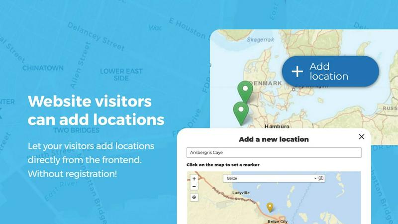
About Open User Map
Open User Map is the fastest way to add an interactive, community-driven map to your WordPress site without writing a single line of code. Forget wrestling with Google Maps API keys, complex setups, or expensive developer hours. This plugin lets you launch a fully functional map in minutes, not days. At its core, Open User Map empowers your visitors to become contributors. They can add locations, edit their own entries, and upload details directly from the frontend of your site. You retain full control with a built-in approval workflow, ensuring only accurate, vetted information goes live. This makes it an ideal tool for anyone running a community site, local directory, real estate listing, event hub, or tourism platform. With over 15,000 active installs and a perfect 5-star rating, it is the number two map plugin on WordPress.org for a reason. The plugin is lightning fast to set up and use, offering powerful customization through custom fields, categories, and advanced filtering without slowing down your workflow. Whether you need a simple pin drop map or a complex interactive guide with lines, areas, and custom images, Open User Map delivers speed and efficiency at every step. It is built for site owners who want results fast and refuse to get bogged down by technical hurdles.
Features of Open User Map
Frontend Submissions with Approval Workflow
Speed up your data collection by letting visitors add and edit locations directly from the frontend of your site. They click a button, place a marker, and fill in the details. You do not have to manually input every entry. The built-in approval workflow gives you instant control. New submissions are held for your review, so only verified, accurate locations go public. This feature eliminates back-and-forth emails and keeps your map updating at lightning speed.
Advanced Filter Interface
Give your users the power to find exactly what they need in an instant. The Advanced Filter Interface creates a sidebar next to your map that lets visitors filter locations by any custom field you have set up. You can also inject custom HTML for branding or additional information. This turns a simple map into a dynamic search tool, helping users zero in on specific categories, ratings, or attributes without scrolling through endless markers.
Custom Image as Map
Transform any image into a fully interactive map at lightning speed. Upload a floor plan, event layout, campus guide, or seating chart, and let users place markers directly on it. This feature bypasses traditional geography entirely, allowing you to create interactive experiences for indoor spaces or conceptual diagrams. All the powerful functionality of a standard map, including custom fields and filtering, works seamlessly on your image.
Lines and Areas
Go beyond simple pins by adding routes, paths, zones, and regions to your map. This feature is perfect for highlighting trails, service areas, event grounds, or construction zones. Distances and area sizes are calculated automatically, giving you helpful measurements right out of the box. Whether you are mapping a hiking trail or defining a neighborhood boundary, this tool adds a new layer of context and utility to your map quickly.
Use Cases of Open User Map
Community-Driven Local Business Directory
Let your community build the ultimate local guide. Visitors can quickly add their favorite coffee shops, restaurants, or service providers directly on the map. Use the approval workflow to verify submissions, and leverage custom fields for hours, contact info, and star ratings. The upvote feature helps the best spots rise to the top, creating a self-sustaining directory that updates itself at lightning speed.
Interactive Event and Festival Maps
Speed up event logistics with a custom map that attendees can contribute to. Use the Custom Image as Map feature to upload a festival layout or venue floor plan. Vendors can add their own booth locations, and organizers can mark stages, restrooms, and first aid stations. The Lines and Areas feature is perfect for defining parade routes or no-go zones, giving attendees a clear, interactive guide instantly.
Real Estate and Property Listings
Accelerate your property listings by allowing agents or homeowners to pin available properties directly on a map. Categorize markers by property type (house, condo, land) and use custom fields for price, bedrooms, and square footage. The Advanced Filter Interface lets buyers instantly filter by their criteria, turning your map into a lightning-fast property search tool that updates in real time.
Tourism and Travel Guides
Create a living travel guide that locals and visitors can update instantly. Allow users to pin hidden gems, scenic viewpoints, and recommended hiking trails. Use the Regions feature to organize by neighborhoods or districts, and enable star ratings to highlight the best attractions. The Upvotes feature helps you identify the most popular spots, keeping your guide current and useful without constant manual input.
Frequently Asked Questions
Do I need a Google Maps API key to use Open User Map?
No, you do not. Open User Map is designed to work without any Google Maps API key. This eliminates a major headache and cost associated with other map plugins. You can set up and run your interactive map instantly without dealing with API credentials or billing accounts.
How does the approval workflow for frontend submissions work?
When a visitor adds a location from the frontend, it is saved as a pending submission. It will not appear on the public map until you approve it from your WordPress admin dashboard. This gives you complete control over content quality and prevents spam or inaccurate data from going live. You can approve, edit, or reject submissions with a single click.
Can I customize the look and fields of my map?
Absolutely. Open User Map offers powerful customization options. You can add custom fields like text boxes, dropdowns, checkboxes, and links to collect specific data. You can also create marker categories with unique icons and colors. The Advanced Filter Interface allows you to build a custom filtering sidebar, and you can even use a custom image as your map background.
Is there a free version of Open User Map?
Yes, there is a free version available for download on WordPress.org. It includes core features like frontend submissions, approval workflows, and basic categorization. For advanced features like Lines and Areas, Custom Image as Map, Advanced Filter Interface, and star ratings, you can start a 7-day free trial of the PRO version with no credit card required.
Similar to Open User Map

Custom PHP websites, AI Indexing Pack ($599 one‑time), and WebAgentScan SaaS ($9/mo). MCP, A2A, llms.txt, full ownership.

Unifyca gives you lightning-fast centralized control over every client WordPress site's documentation, maintenance, and backups.

The Tool Empire offers 82 powerful, free, browser-based tools for developers, designers, writers, and students without any sign-ups or server delays.

Ship production-ready React and Tailwind UI blocks fast with Shadcn Examples.

360 Solution delivers instant, privacy-first online tools for developers and creators with zero signup or friction.

Dayter is your free online countdown calendar that tracks key dates and sends reminders so you never miss a moment.

Webleadr instantly finds and contacts web design leads and businesses without websites anywhere in just a few clicks.

Idearium builds fast, high-converting websites that drive rapid business growth.